 | In the Field
Current IFA Projects at Abydos
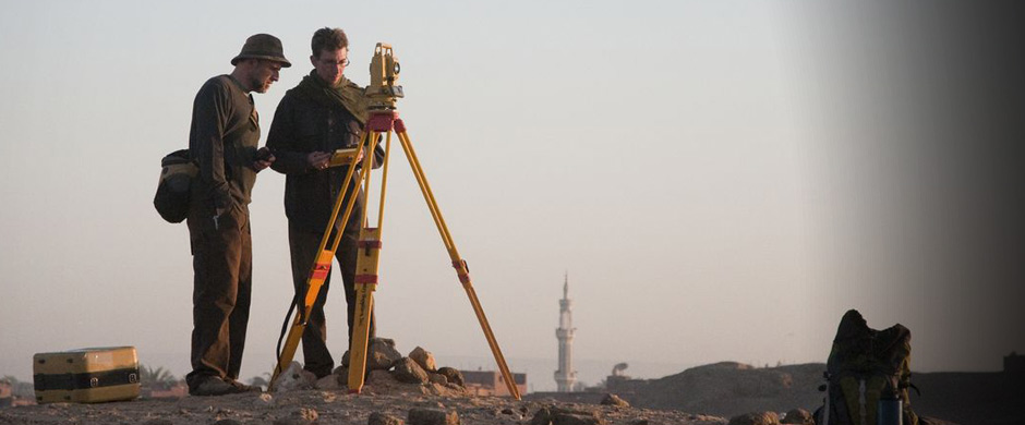
The Greater Abydos Survey
The Institute of Fine Arts, in collaboration with the University of Pennsylvania Museum and with the financial support of Mr. Bruce Mainwaring, has undertaken the first systematic topographic survey of the entirety of the site of Abydos. Through a combination of on-the-ground survey, using a total station and Global Positioning System (GPS) devices, and tasked high-resolution Quickbird satellite imagery, the Institute’s Greater Abydos (GrAb) Survey Initiative has acquired detailed data from all parts of the site. The survey has allowed the Institute to produce the first detailed map of the site ever created, which now affords precise spatial control of all ancient and modern features present at Abydos, and which will serve as the basis for all future archaeological work at the site. Cartographic and archaeological data are being combined in an associated comprehensive GIS (geographical information systems) database.